CYPRESS CREEK DRAINAGE IMPROVEMENT DISTRICT
  • Home
  • About
  • Leadership
  • Documents/Resources
  • Maps
  • In the News
  • NEWSLETTER
  • Contact Us
Picture

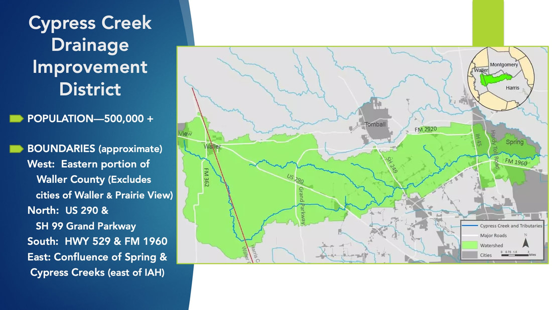
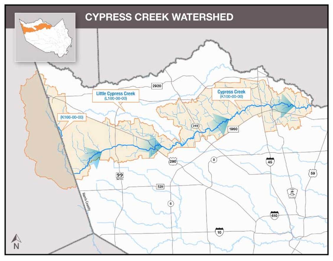
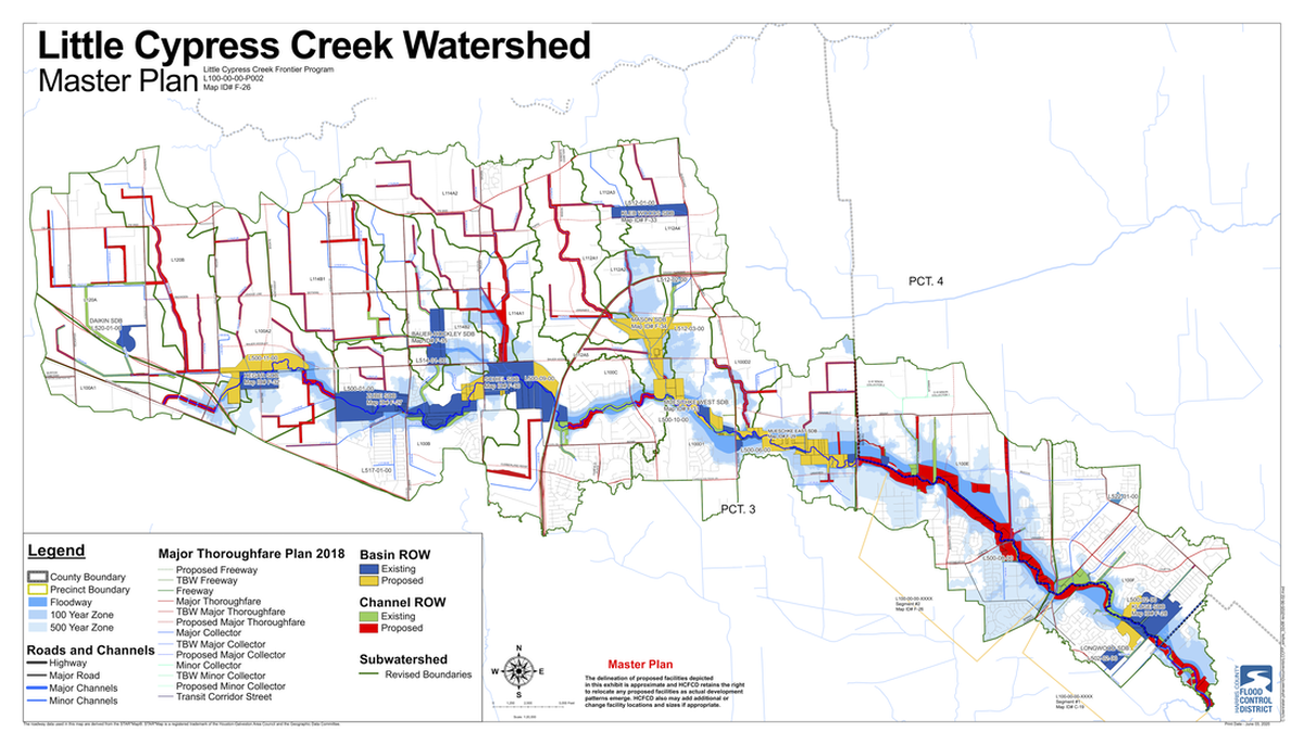
CYPRESS CREEK WATERSHED MAPS

DRAFT:   FEMA FLOODPLAIN MAAP REVISIONS
Picture
Changes in Flooding Risk Zones
Let your voice be heard
Participate in the Harris County Flood Resilience Plan Survey.

​Click HERE

Picture
ADDITIONAL GIS SAMPLE MAPS—Proposed Projects
quiddity_gis_maps_overall_8.5x11.pdf
File Size: 1937 kb
File Type: pdf
Download File

Picture
Picture
Picture

Cypress Creek Drainage Improvement District

About
Leadership
Documents/Resources
Maps
​In the News

Contact Us 
for Information & Community Input

[email protected]​
Fact Sheet
Calendar

​​ Contact Webmaster/Designer
© COPYRIGHT 2015.
​ALL RIGHTS RESERVED.
  • Home
  • About
  • Leadership
  • Documents/Resources
  • Maps
  • In the News
  • NEWSLETTER
  • Contact Us